Roman Emperor Hadrian's Aqueduct to supply ancient Athens with water
(Photos: February 2009)
Athens 2004 Olympic Village
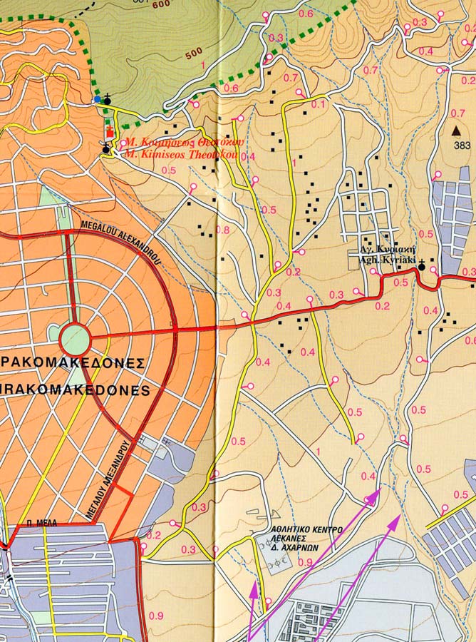
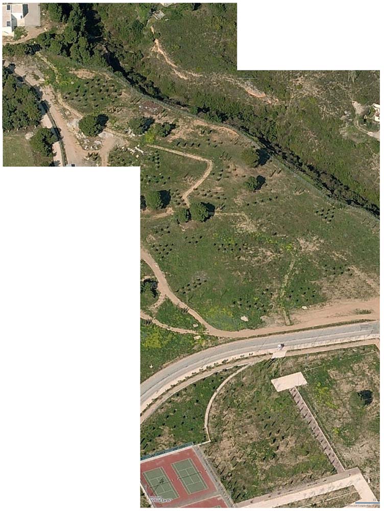
The Sources of Water for Hadrian's Aqueduct
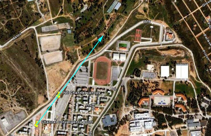
The system of tunnels and channels at the olympic village are ideally located to tap multiple-converging streams arriving just north of the village.
Extending the N & N-E channel and N-E tunnel directions of the aqueduct (purple arrows) indicate that they
would intersect the streams running down from Mount Parnitha (dotted blue lines) at ideal locations.
If normal Roman practice were followed, small cisterns would have been built at the water sources to ensure a
constant water flow. Hopefully, remains of these cisterns still exist.
[To be investigated & documented here]
To ensure a constant supply of water to Athens these streams would need to flow throughout the year
and so would need to be fed from reliable springs as well as seasonal run-off from rain and melting snow.
Some Indications & Clues as to the Location of the Water Sources:
NORTH CHANNEL
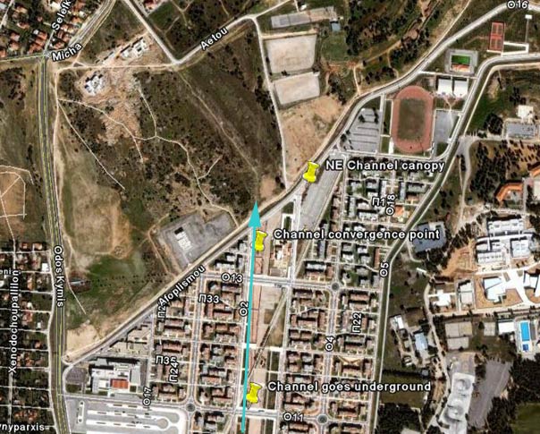
The North going channel direction when extended shows a straight line where the aqueduct
channel was found to be buried.
It appears to terminate in a river bed. However, when investigated
this turned out not to be the case.
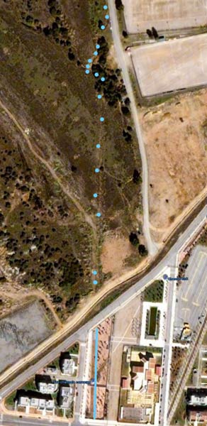
My GPS survey in March 2009 recorded visible parts of the channel extending northwards as predicted.
(see blue dots in photo above). (The northernmost point is located at 38 07' 13.92'' N, 23 46' 05.34'' E).
Instead of terminating at the river bed (which was dry) , the channel continued across it and
headed north
and
then seemed to disappear under the road. The continuation route & destination is
as yet unknown.
[To be further investigated & documented here in due course ]
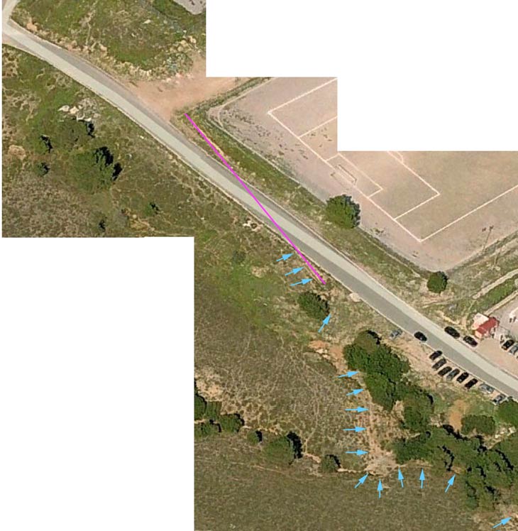
The upper-end of the channel showing where it disappears under the road.The blue arrows indicate visible
sections of the channel.
It's possible route north (in line with
the existing channel) is shown in pink.
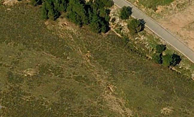
Enlarged view of the lower section of the field (immediately north of the Olympic Village)
-
showing holes where the channel cover has collapsed.
The image above this is a continuation of this image.
NORTH-EAST CHANNEL
The North-East going channel when the direction is extended lines-up with a long excavated trench in a field.
This may be the continuation of the aqueduct channel.
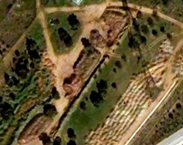
Enlarged view of the trench across the field.
[To be investigated later & documented here]
NORTH-EAST TUNNEL
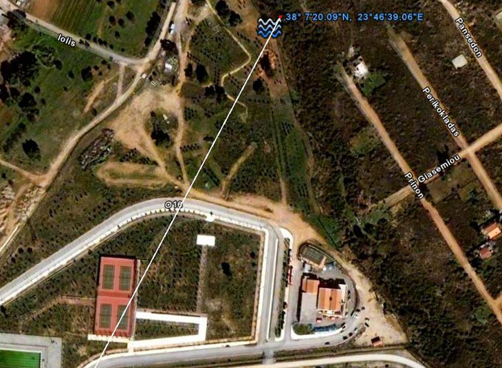
Extension line of NE going tunnel showing possible source & location of water. This river bed is the result
of the convergence of many streams further up the mountain (see map above) and should be a reliable
source of water.
Note the red roofs of the Fire Station (just right of centre).
What may be a covered channel appears to start in the garden to the right of the tennis courts (exactly where the N-E
underground tunnel would be projected to be located), cross under the road (with a marker) and wind it's way up to
the river bed. The fact that it is not straight is strange - unless it had to follow the contour of the land - or it was a later
add-on to the system.
MARCH 2009 - The above turned out to be a paved walkway (now mostly overgrown) into the field (presumably planned
for use
by the olympic atheletes to provide a quiet & restful walk - but later blocked by the high fence (presumably
when it was realised the area was not secure).
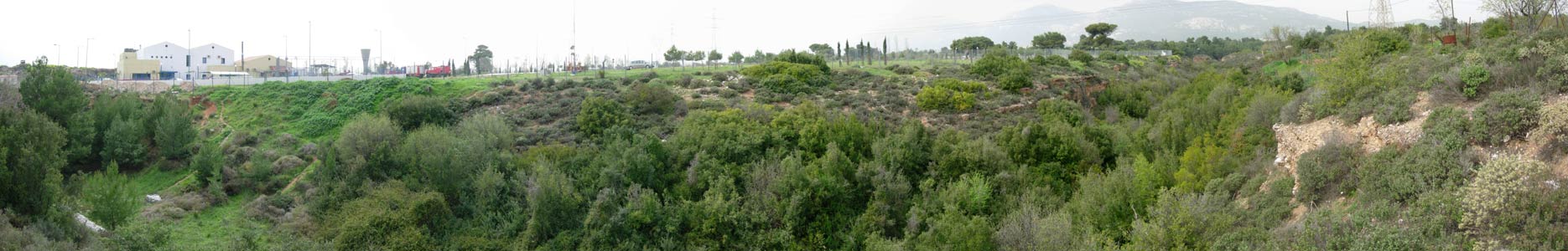
A further survey (March 2009) revealed a wide, dry river bed filled with dense bushes and trees. The tunnel exit could not be found.
Note the fire station (white and yellow buildings) and Mount Parintha to the far right of the panoramic photo (looking north).
The width and depth of the river bed indicate substantial river activity in the past. The river bed is actually fenced-off but a small gate
gives access - just opposite the fire station.
The aqueduct tunnel appears to be very deep and may actually pass under this river bed to meet with a constant source of water in another location.
[To be further investigated]
Photos (C) Robert J. Horne