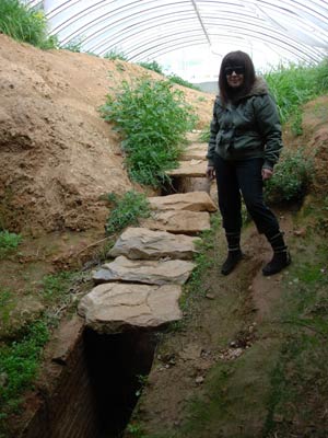
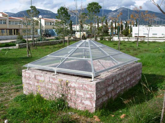
(The canopy covers the exact position where the surface channel slopes down, goes underground and becomes a tunnel)
Roman Emperor Hadrian's Aqueduct to supply ancient Athens with water
(Photos: February & March 2009)
Athens 2004 Olympic Village
- THE UNDERGROUND SECTION OF THE AQUEDUCT -
Starting location (at the approximate centre of Olympic village): 38° 06' 40.06" N, 23° 46' 05.77" E
(The canopy covers the exact position where the surface channel slopes down, goes underground and becomes a tunnel)
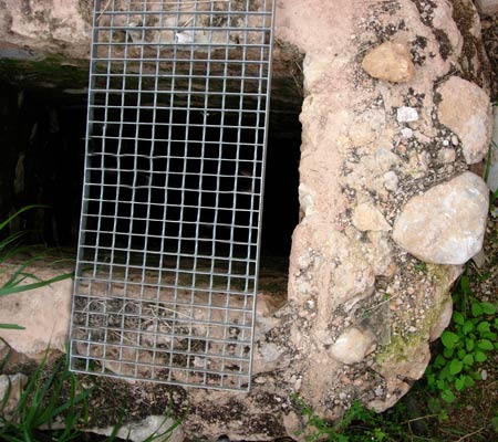
Detail view of brick/tile lining of the connecting channel leading from the
surface channel
down
to the tunnel entrance (under the canopy).
The following photos were taken on an exploration of a preliminary section
of the underground tunnel on 31 March 2009:
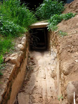
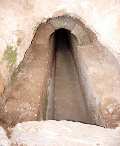
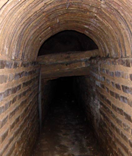
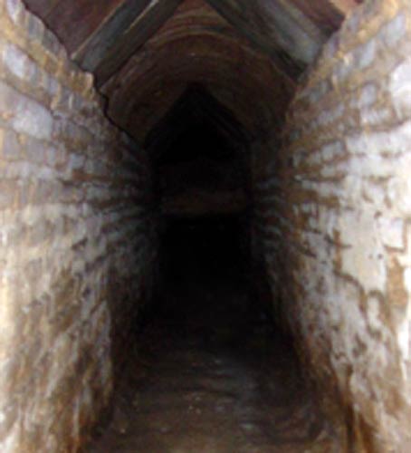
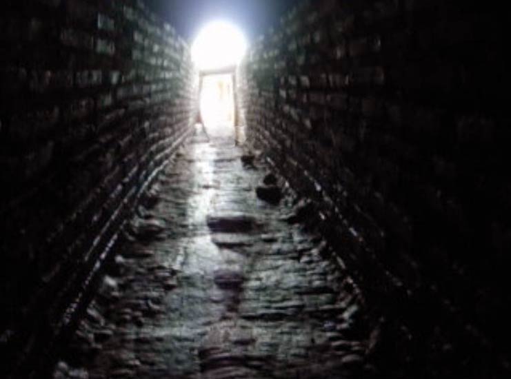
View looking North & upwards towards the surface - from the entrance of the tunnel.
Channel enlarges as it leads to the tunnel entrance.
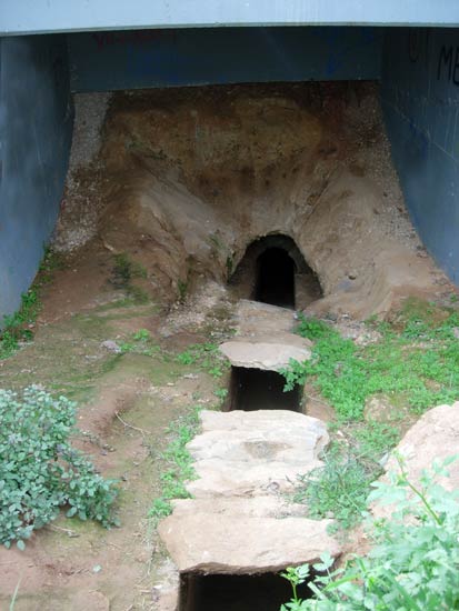
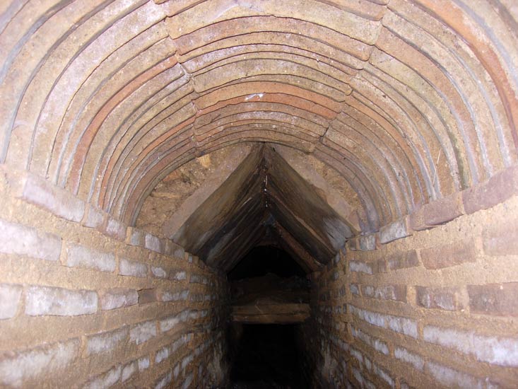
Under the canopy - the channel goes underground (Right - closer, inside view to show impressive brick lining & arch of the tunnel).
First exploratory views inside the tunnel using video:
First in natural light (left) and then with the camcorder's IR night-light (right)
Looking into the entrance of the tunnel.
From here we move down inside the tunnel.
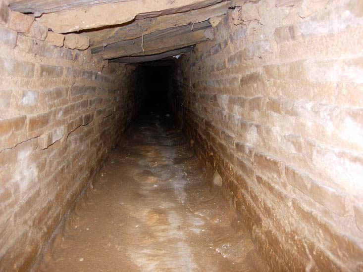
The tunnel floor slopes steeply downwards in a straight ramp and is slippery
from the
hundreds of years of mineral (mostly limestone) deposit.
This slope does not show in the photographs.
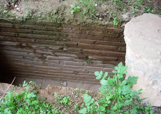
Any smooth item accidentally dropped just slides down the tunnel floor
and on until out of sight in the darkness.
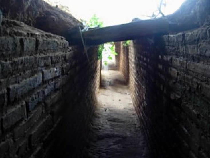
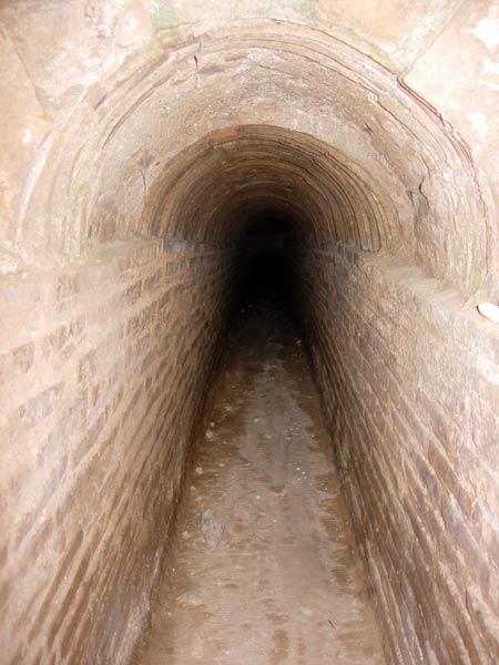
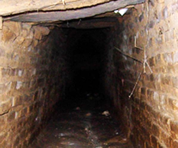
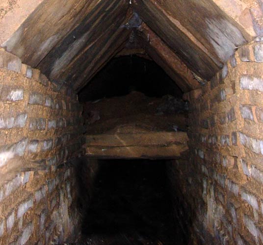
Progressing and stooping along & down the tunnel the roof is seen to be lowered ahead.
The arched roof in this section is replaced by a flat rock covering
and crawling is now necessary.
The distance from the tiled-faced arched entrance to the tunnel to this
(first) roof change was measured to be 9.5 metres (31 feet).
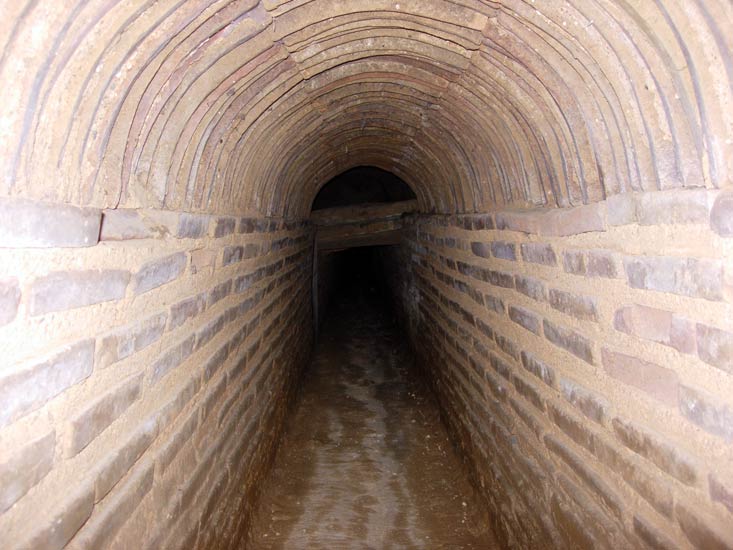
Crawling along and down the sloping tunnel.
Down into the darkness.
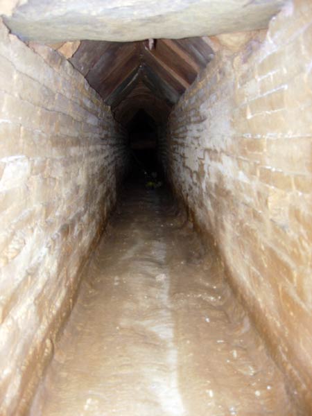
The aqueduct roof now becomes pointed and it's possible to walk with a stoop again.
The tunnel roof now returns to an arch style for a short section.
Back to the pointed roof style and then the roof lowers right down again.
Back to crawling again. Here the exploration stopped for this expedition.
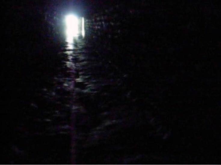
Returning up the tunnel - just using daylight for illumination.
Nearing the entrance to the tunnel. The sloping floor can clearly be seen.
Quite an effort is required to crawl up a slippery
slope.
UNDERGROUND AQUEDUCT (TUNNEL) ACCESS POINTS
Access points or shafts were made every 35 metres along the tunnel to facilitate construction of the tunnel and to provide easy maintenance.
Many of these shafts are present within the Olympic Village and each of the non-buried ones are covered by a canopy.
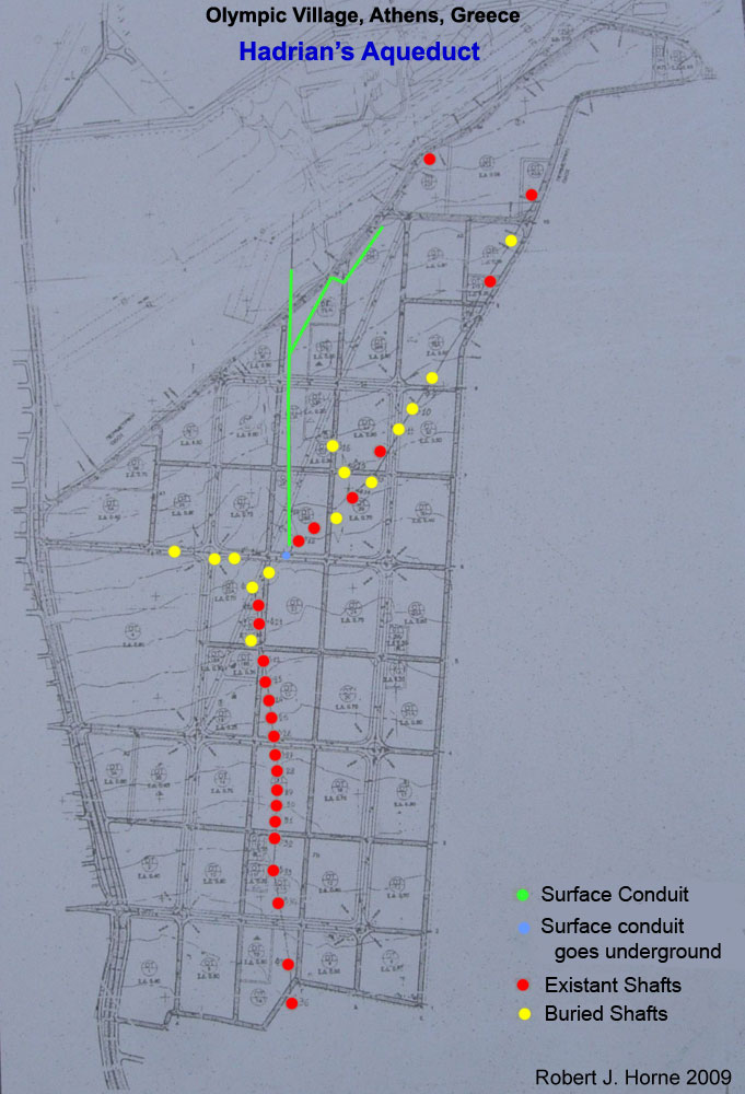
Map showing the multiple sources of water that were directed into the main aqueduct.
The red and yellow dots indicate the position of known access points to the tunnels.
The red dots show the location
of the plexiglass-covered shafts.
The yellow dots indicate shafts that have been covered-over during
the building of the village.
The northern-most shaft cover on the N-E heading tunnel. Location: 38° 07' 02.65" N, 23° 46' 27.56" E
(Close to the running track)
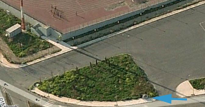
Satellite image showing this shaft access point.
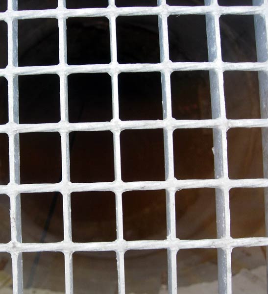
View through the plexiglass cover and down the shaft - indicating a deep tunnel.
A concrete liner extension to the original shaft has been inserted to bring the shaft
to the surface for viewing.
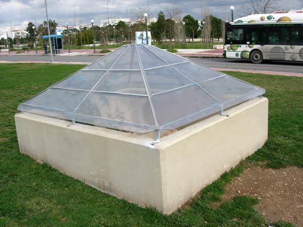
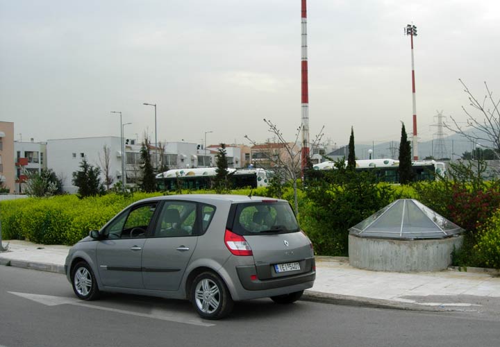
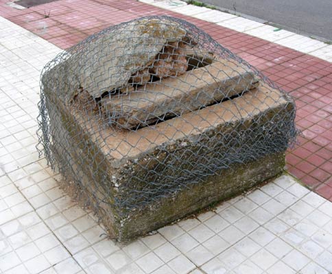
A typical wall & canopy showcasing & protecting a shaft giving access to the underground aqueduct tunnel.
The squarish shaft & stone cover - protected by the canopy.
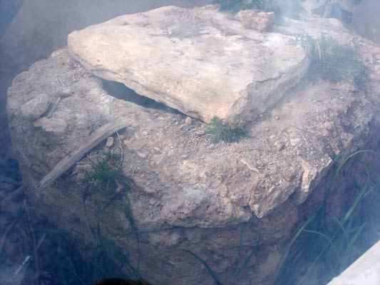
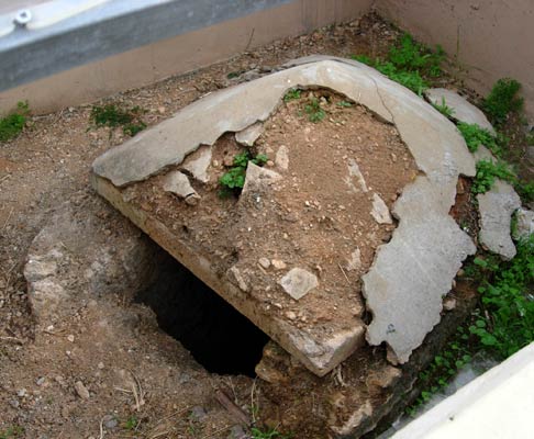
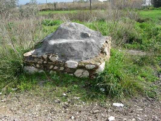
Another example - round and capped with earth & mortar.
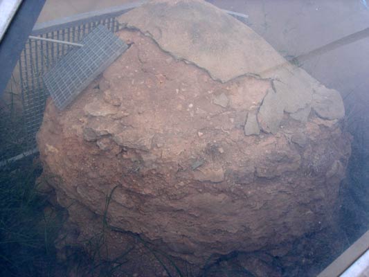
Another, projecting from the pavement.
Another, round and exposing the shaft leading down to the aqueduct tunnel.
Canopy next to the Olympic Village's Greek Orthodox chapel.
The round shaft and stone cover.
Uncovered shaft dropping down to the aqueduct tunnel below.
Another style of cover.
Outside the southern end of the Olympic Village (on the edge of a farm).
Located at: 38° 06' 10.81" N, 23° 46' 05.14" E
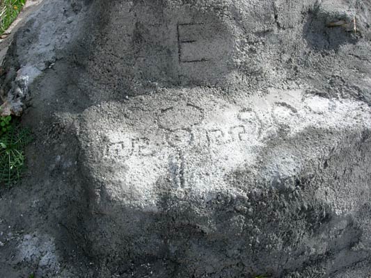
Recently recovered with cement.
Photos (C) Robert J. Horne